
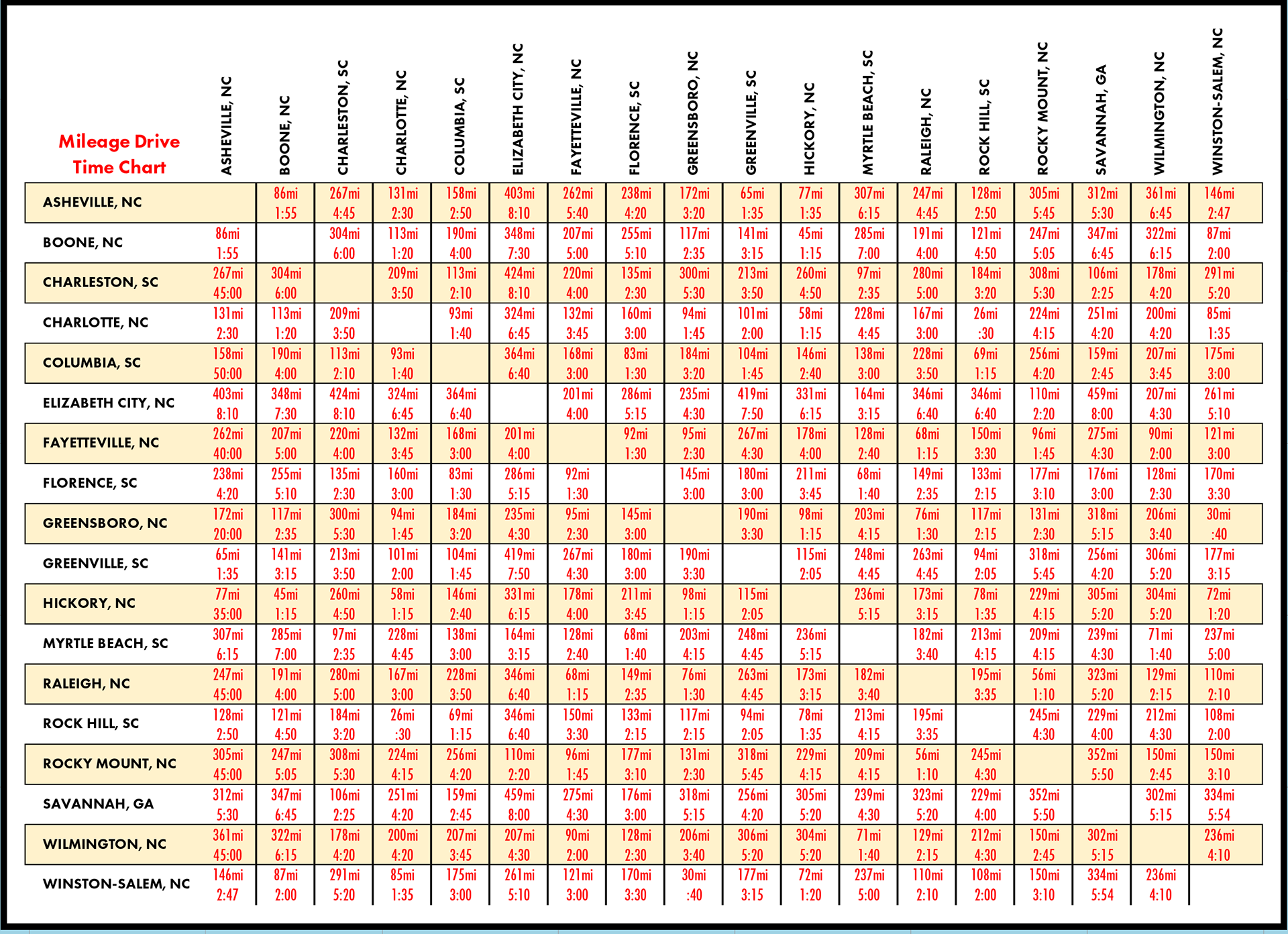

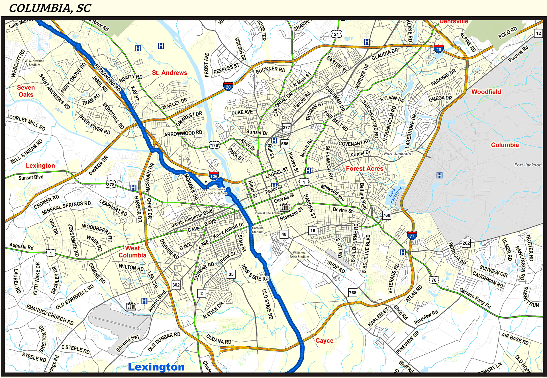
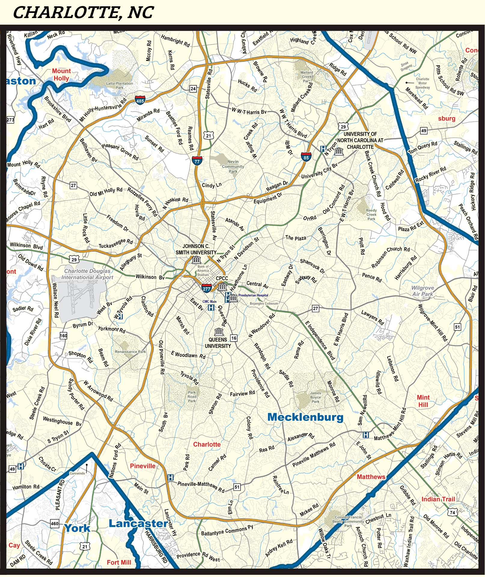


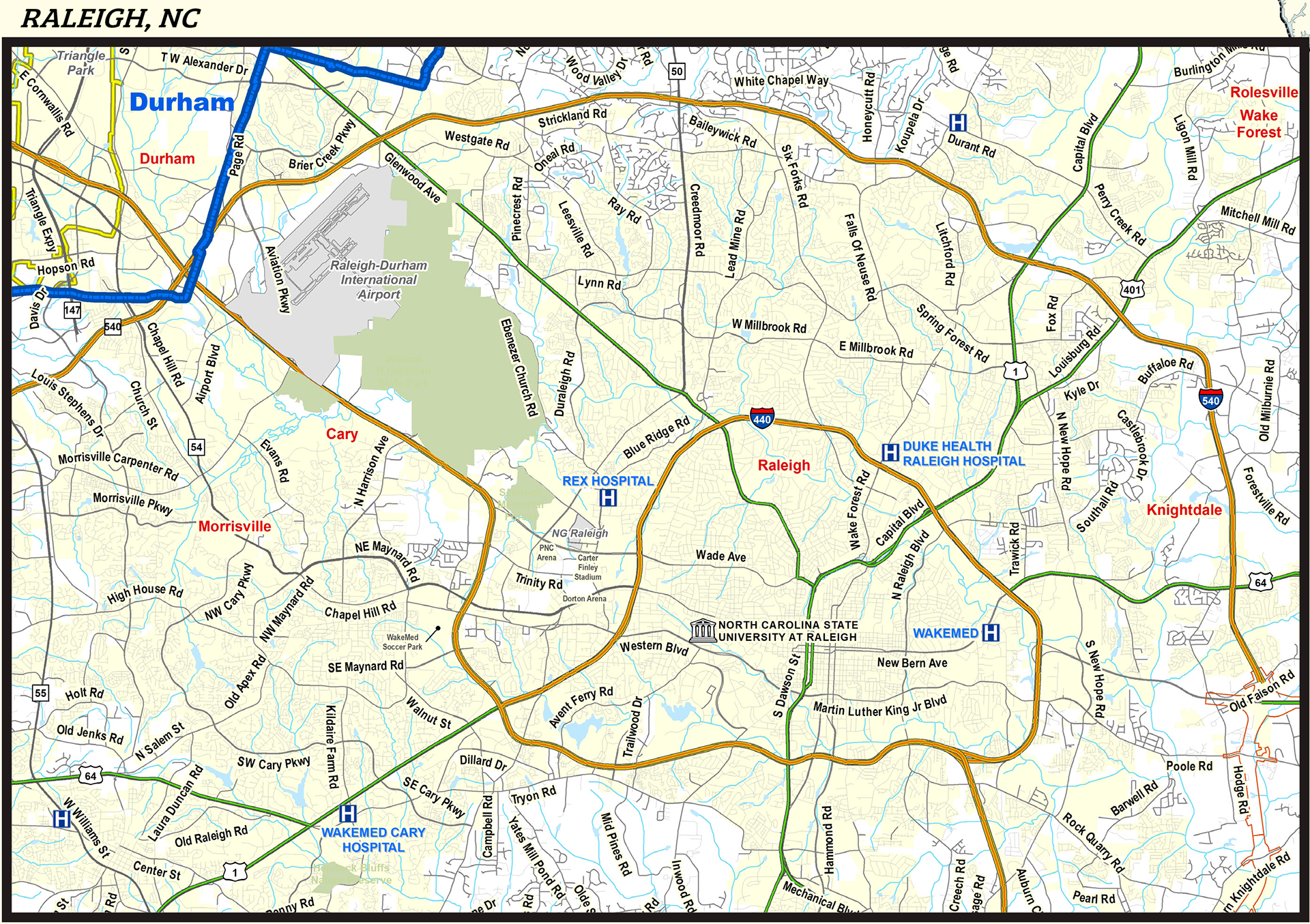
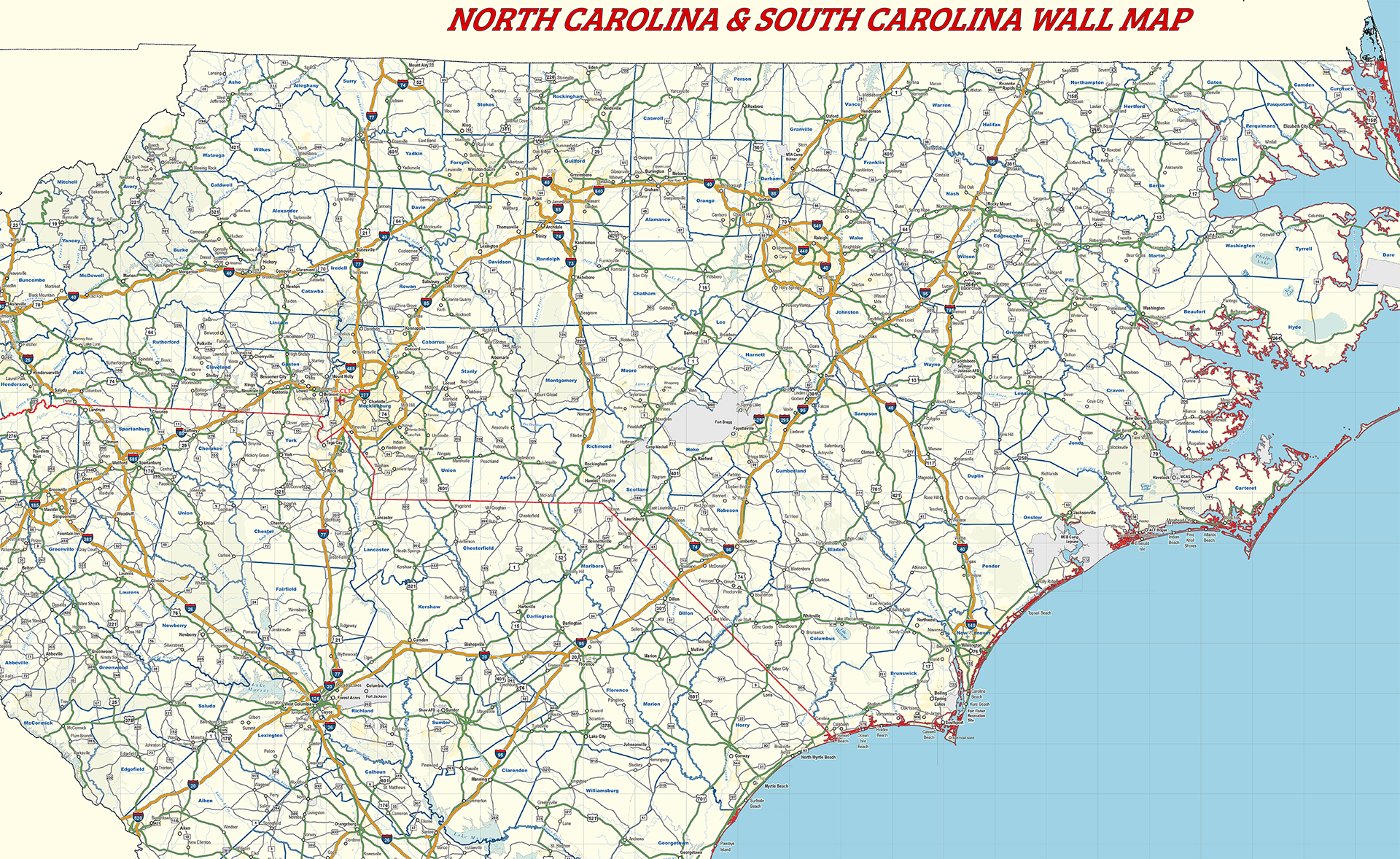

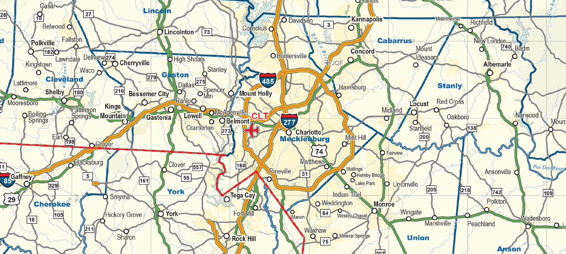
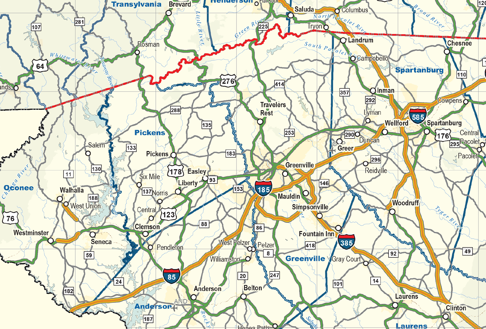


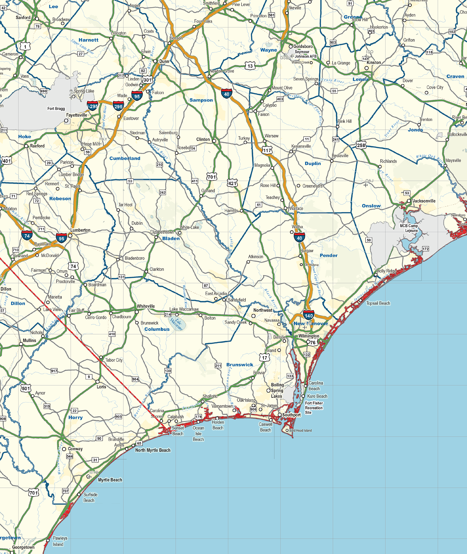


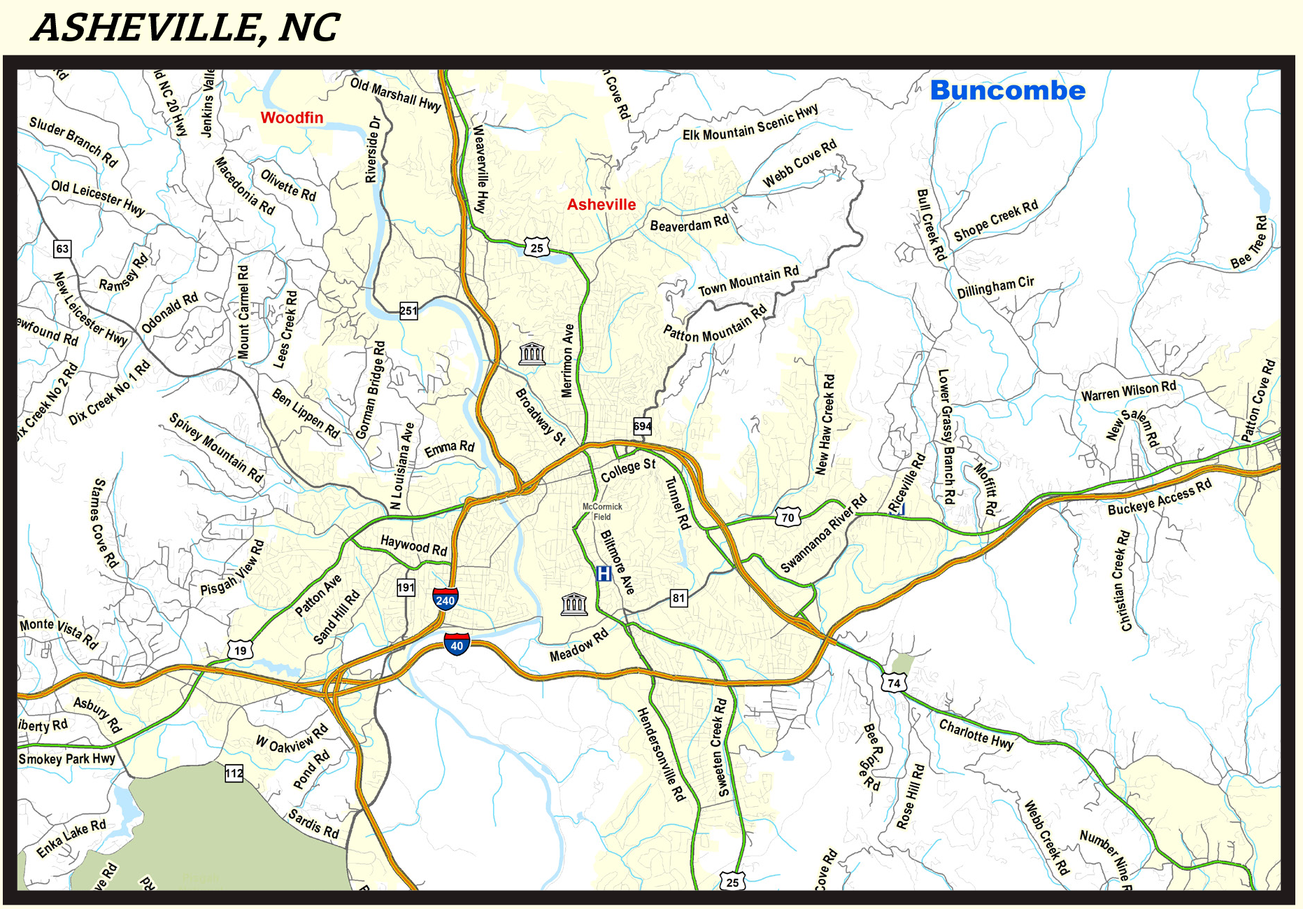

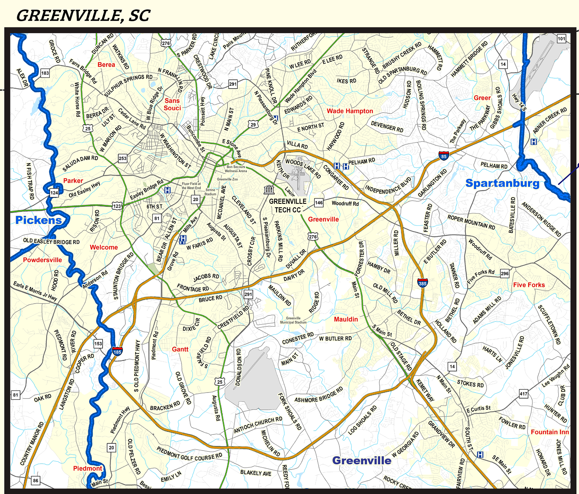

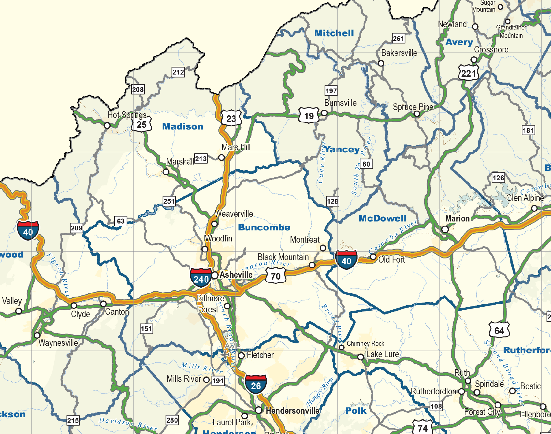


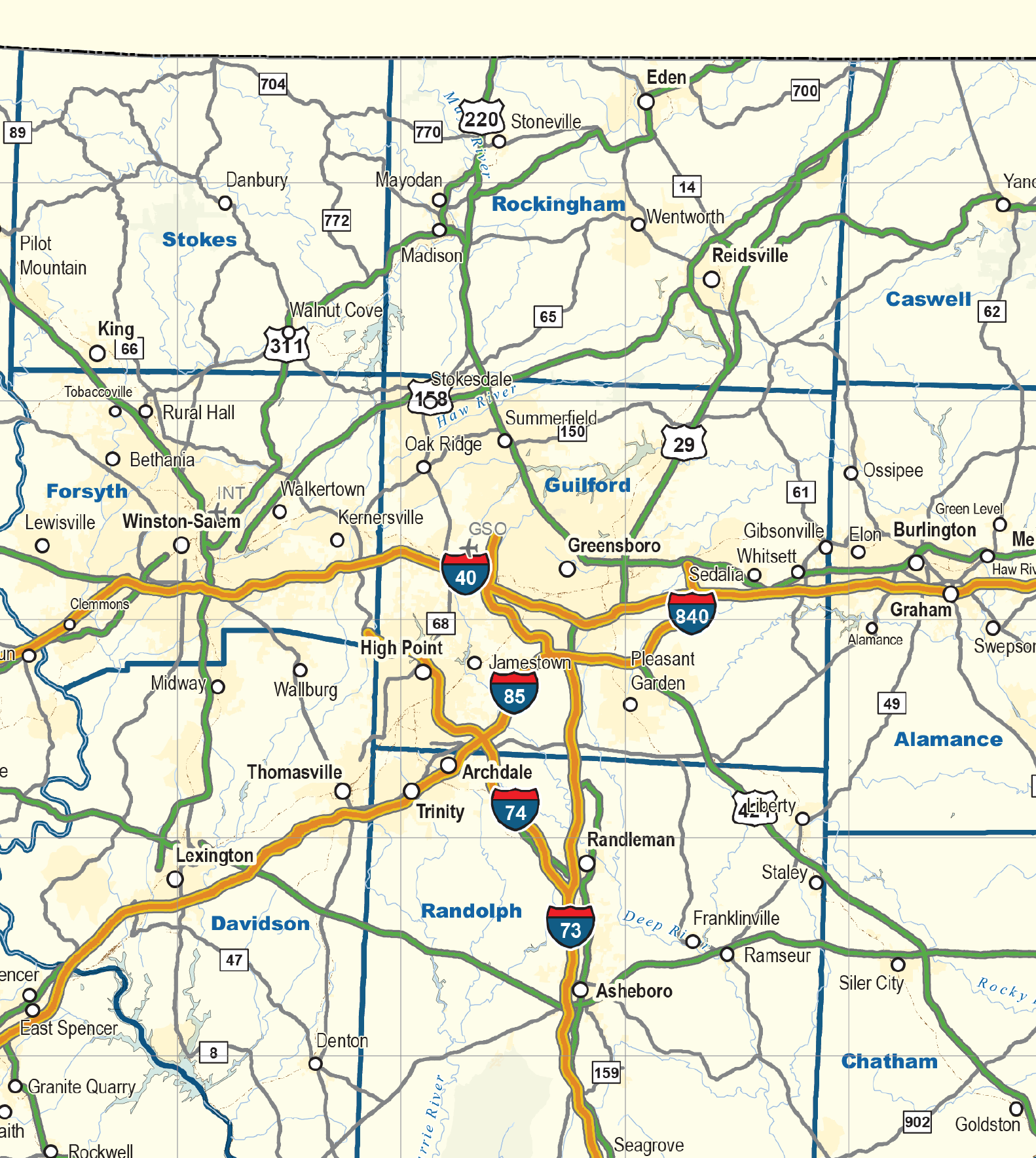
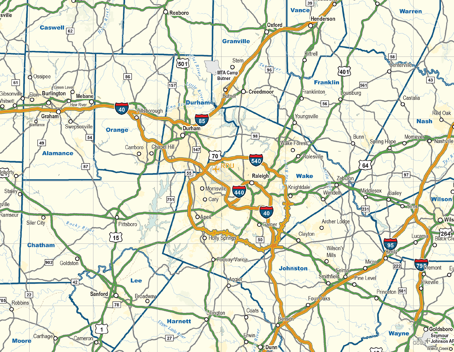
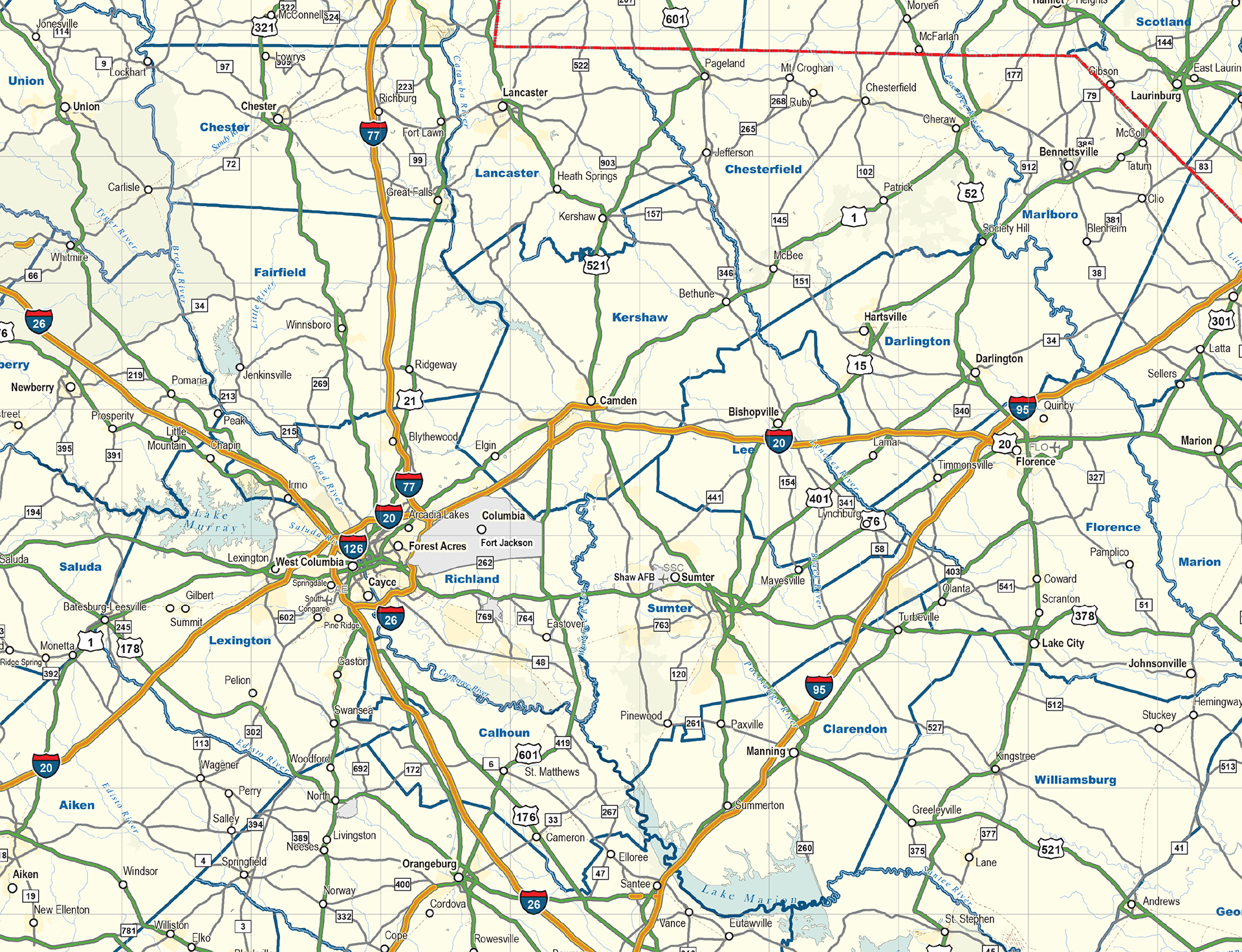
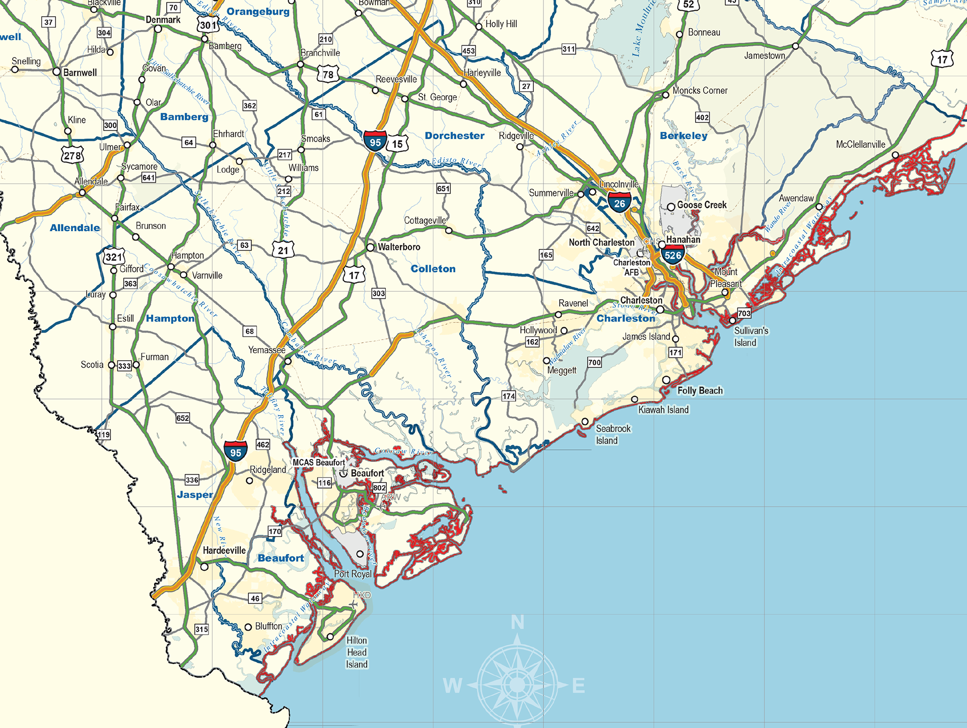
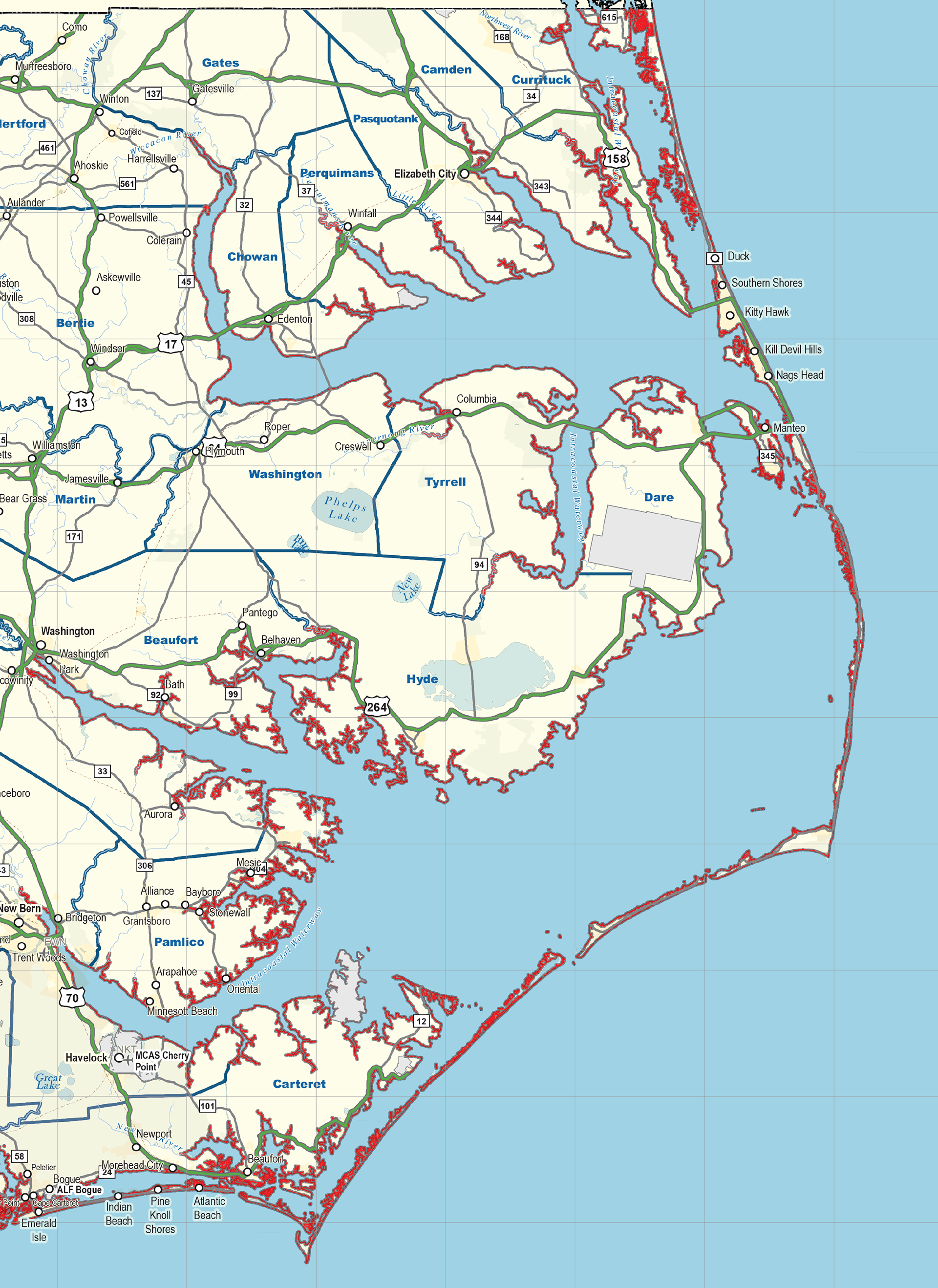


Oversized Wall Map of North Carolina and South Carolina containing all Cities and Towns, Interstates and Highways as well as Point of Interest locations like Airports, National Forests, State Parks, Military Bases and Facilities and Major Waterways. Additionally the map contains a drive-time chart from Major Cities within the Carolinas region, as well as several inset maps of Major Metropolitan areas and POI within (Hospitals and Major Universities) including: Greenville, SC - Asheville, NC - Charlotte, NC - Raleigh, NC - Columbia, SC.

